 Tweet
Tweet
As discussed by Robert at the Mojave Meeting tonight, the APRS system available to licensed HAM radio users is a very neat system. I'm using it in basic form to locate and track my truck, this way my family/friends back home will know where I'm and I can use the data later to retrace a route.
For example, here is a trip we did last fall, Four Corners Utah to 3 Corners (UT/ID/NV) almost entirely on dirt. We had the tracking enabled so that our family and back-up plans back home knew where we were.
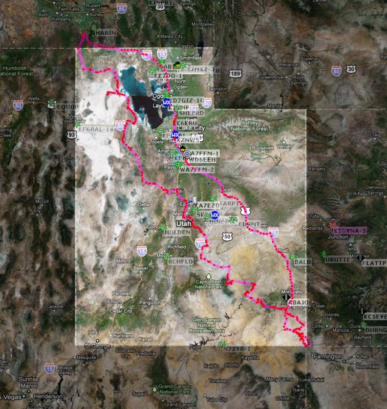
All of the red dots are points the APRS system automatically 'checked-in'. Using the aprs.fi website, you can view when, where, and how fast we were traveling at each point as well as which repeater picked up our broadcast. So assuming we were lost, broken down or injured, a team member back home could at least know where we were at.
For example, here is a trip we did last fall, Four Corners Utah to 3 Corners (UT/ID/NV) almost entirely on dirt. We had the tracking enabled so that our family and back-up plans back home knew where we were.
All of the red dots are points the APRS system automatically 'checked-in'. Using the aprs.fi website, you can view when, where, and how fast we were traveling at each point as well as which repeater picked up our broadcast. So assuming we were lost, broken down or injured, a team member back home could at least know where we were at.
Comment